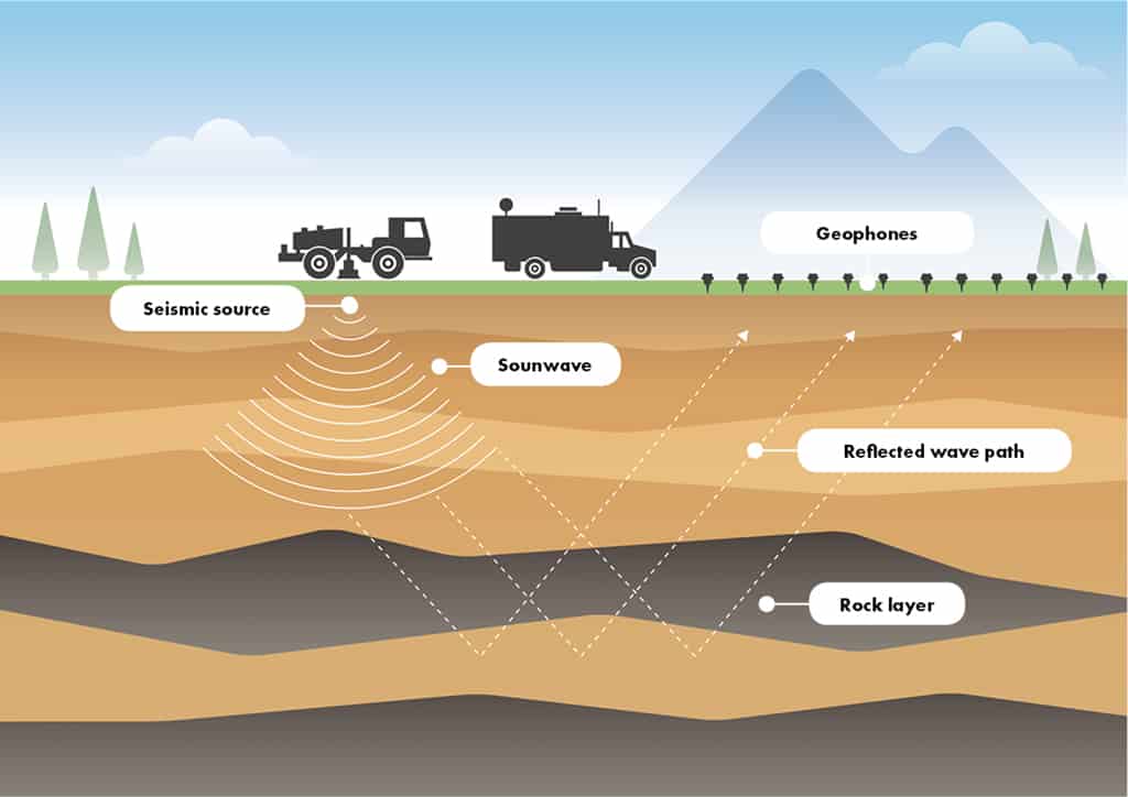
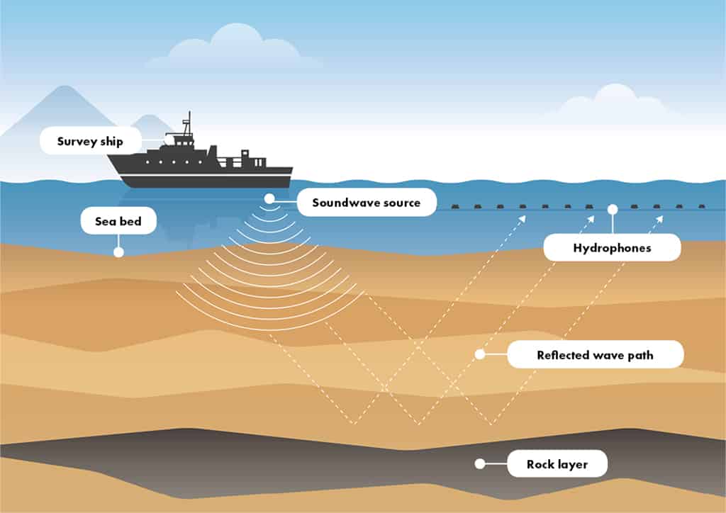
Seismic surveys
Companies use seismic surveys to produce detailed images of local subsurface geology to determine the location and size of possible oil and gas reservoirs.
Explorers generate seismic (sound) waves and measure the time taken for the waves to travel from the source, reflect off subsurface features and be detected by receivers at the surface. This can help build an image of the subsurface.
Information in the seismic signal can also be used to indicate features such as rock density and the likely presence of fluids or gases.
Offshore Seismic
In offshore operations, a specialised vessel tows a collection of cables or ‘streamers’. One set with seismic sources that use compressed air to produce acoustic energy and another set with hydrophones attached that capture the returning sound waves for later analysis.
Onshore Seismic
Onshore operations usually use specialised trucks that carry a heavy plate that is vibrated to generate a seismic signal and a series of geophones laid out on the ground to record the returning sound waves for later analysis.